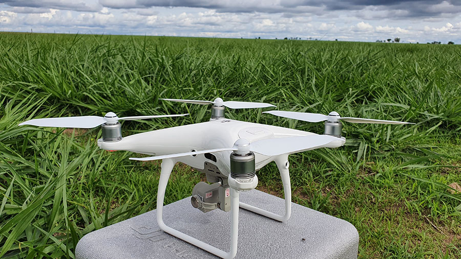
Research by Embrapa correlated digital data obtained from drone images with field data for two years of monitoring in the west of Bahia state. The results reinforce the qualification of such remote sensing tool to assist in the fields, optimizing time and aiming at efficiency in rural production. The goal is to help farmers manage their herds, considering plant height, forage and plant cover in their pastures. The experiments relied on artificial intelligence to establish pasture monitoring parameters, which can be extended to other Brazilian regions. In addition, the digital images generate visual databases that are easily accessible and shareable. Research by Embrapa shows that the use of drones to monitor pasture cover and height reached 66% accuracy in Bahia's Cerrado biome. The experiments, which were held between 2019 and 2021, reinforce the qualification of such remote sensing tool to increase efficiency in agriculture, as it optimizes time and productivity in the fieldwork and expand the ability to observe and control production. The research was carried out at the Trijunção Farm, in the village of Cocos, in the countryside of Bahia state, in a beef cattle farming system with rotational grazing and use of the BRS Piatã cultivar of Brachiaria grass. According to Embrapa Southern Livestock researcher Márcia Silveira, the work compared digital data on pasture height and soil cover, captured from the images made by drones, with the figures obtained in the field with traditional measurement methods like assessment by a trained team and measurement with a ruler, or soil cover assessment and forage sampling. “Our goal was to check whether an ordinary drone, which can be acquired by a farmer, combined with machine learning, could help to estimate plant cover and plant height. We wanted to evaluate whether the correct use of this tool can help them in decision-making related to cattle management, through the comparison between the drone-generated images and the field information regarding height measurement, forage cutting, and soil cover by the forage plant,” Silveira explains. The image bands the drones obtained at different times over the course of two years were compared with three classes of soil cover, which represent the management of a cattle farm: pre-grazing, grazing and post-grazing, in addition to a category called exposed soil. The R-Studio data recovery software was used to validate the algorithm and analyze the drone images. The formula they applied combined different image bands to predict cover class and pasture height. The accuracy of the standard was assessed by analysising the software 's confusion (error) matrix and correction matrix. Artificial intelligence helps to correlate pasture management data The methodology used the machine learning technique in a digital environment. According to the agronomist and PhD candidate in Agronomy at the Federal University of Viçosa (UFV), Pedro Almeida, the script developed during the study is a compilation of several tools used for the digital classification of images. “We used the spectral response of the drone images to correlate with pasture management classes. Based on the field data, we compared the variables with the readings performed in the field. In the end, it was possible to establish relationships between soil cover and plant height, making automation in the full area possible, instead of mere statistical sampling,” he says. Considering the entire dataset, the adjusted model reached 66% accuracy and Kappa index 0.53 in the prediction of the four classes (pre-grazing, grazing, post-grazing and uncovered soil stages). The Kappa coefficient measures the agreement between two forms of evaluation – in this case, the software analysis based on the drone images and the conventional measurement made in the field. With regard to the dataset to train the model, the accuracy and Kappa index were 70% and 0.58 for the rainy season, and 68% and 0.56 for the dry season, respectively. Considering the entire training set, the accuracy and Kappa index were 66% and 0.53 within a two-year monitoring period, which included two dry and two rainy seasons,” Silveira notes. Technology reinforces the potential of drones in Brazilian cattle farming Flávia Santos, a researcher at Embrapa Maize and Sorghum and leader of the Trijunção Project in which this study is part, highlights that the development of procedures to process and analyze drone images that Embrapa performed during the study reinforce the benefits of using remote sensing as an auxiliary tool in pasture management. “In the future, these studies can be the basis to create new products, such as smartphone apps, and further optimize fieldwork,” she adds. “With the database referring to only two years it has already been possible to visualize the potential of this type of information. We will continue the monitoring to obtain more data and increase the robustness of the script for machine learning. With more data, we hope to extrapolate this type of information to different types of pastures”, the researcher remarks. The use of UAVs (unmanned aerial vehicles) is another strategy to increase the efficiency of cattle farming, as it helps in pasture planning and management, based on the balance between supply and demand of food for the animals. The key point is the availability of forage in quantity and quality, in addition to maintaining the conditions of quick and vigorous plant persistence and regrowth. “Plant height can be used as a practical criterion to define the ideal grazing time, or to identify the need to make stocking rate adjustments, with the purpose of establishing optimal conditions for the use of pastures through the main processes involved in the growth and use of forage plants under grazing. In order to have such height recommendations be respected, it is necessary to monitor pasture areas more frequently, so as to make more effective decisions to adjust the stocking rate and rotation of animals between areas. Therefore, the use of monitoring techniques, such as remote sensing, shows promise in helping decision-making regarding pasture management”, Silveira concludes. Integration of technologies in the field For Manoel Filho, another researcher at Embrapa Maize and Sorghum, the integration of technologies that increase efficiency in rural property monitoring has been a constant aim in modern agricultural production, with the goal of helping the management and implementation of production processes in a scenario of labor shortages. The west of Bahia, where the study has been taking place, is characterized by production in large expanses and a short production period in upland systems. In this context, the use of practical, far-reaching and reliable monitoring methods like the use of drones is fundamental. “Our work showed the drone's speed to collect information, since it takes only three hours to completely cover an experimental area of over 100 hectares,” says Cláudio Andrade, a geologist and PhD student at the Federal University of Viçosa (UFV). In addition, the images it produces automatically become a visual database that can be easily accessed and made available. The increase in accuracy, as a result of such findings, indicates that this model has the potential to be a significant aid for large-scale pasture management. There is additional monitoring underway by the researcher from the Rio Grande do Sul State Secretariat of Agriculture, Livestock, Sustainable Production and Irrigation (SEAPDR-RS) Carolina Bremm, who works on improving the model's accuracy and validation.
Photo: Embrapa

Experiments back the use of drones to increase efficiency in agriculture
Research by Embrapa shows that the use of drones to monitor pasture cover and height reached 66% accuracy in Bahia's Cerrado biome. The experiments, which were held between 2019 and 2021, reinforce the qualification of such remote sensing tool to increase efficiency in agriculture, as it optimizes time and productivity in the fieldwork and expand the ability to observe and control production.
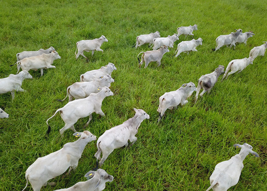
The research was carried out at the Trijunção Farm, in the village of Cocos, in the countryside of Bahia state, in a beef cattle farming system with rotational grazing and use of the BRS Piatã cultivar of Brachiaria grass. According to Embrapa Southern Livestock researcher Márcia Silveira, the work compared digital data on pasture height and soil cover, captured from the images made by drones, with the figures obtained in the field with traditional measurement methods like assessment by a trained team and measurement with a ruler, or soil cover assessment and forage sampling.
“Our goal was to check whether an ordinary drone, which can be acquired by a farmer, combined with machine learning, could help to estimate plant cover and plant height. We wanted to evaluate whether the correct use of this tool can help them in decision-making related to cattle management, through the comparison between the drone-generated images and the field information regarding height measurement, forage cutting, and soil cover by the forage plant,” Silveira explains.
The image bands the drones obtained at different times over the course of two years were compared with three classes of soil cover, which represent the management of a cattle farm: pre-grazing, grazing and post-grazing, in addition to a category called exposed soil. The R-Studio data recovery software was used to validate the algorithm and analyze the drone images. The formula they applied combined different image bands to predict cover class and pasture height. The accuracy of the standard was assessed by analysising the software 's confusion (error) matrix and correction matrix.
 Artificial intelligence helps to correlate pasture management data Artificial intelligence helps to correlate pasture management data
The methodology used the machine learning technique in a digital environment. According to the agronomist and PhD candidate in Agronomy at the Federal University of Viçosa (UFV), Pedro Almeida, the script developed during the study is a compilation of several tools used for the digital classification of images. “We used the spectral response of the drone images to correlate with pasture management classes. Based on the field data, we compared the variables with the readings performed in the field. In the end, it was possible to establish relationships between soil cover and plant height, making automation in the full area possible, instead of mere statistical sampling,” he says. Considering the entire dataset, the adjusted model reached 66% accuracy and Kappa index 0.53 in the prediction of the four classes (pre-grazing, grazing, post-grazing and uncovered soil stages). The Kappa coefficient measures the agreement between two forms of evaluation – in this case, the software analysis based on the drone images and the conventional measurement made in the field. With regard to the dataset to train the model, the accuracy and Kappa index were 70% and 0.58 for the rainy season, and 68% and 0.56 for the dry season, respectively. Considering the entire training set, the accuracy and Kappa index were 66% and 0.53 within a two-year monitoring period, which included two dry and two rainy seasons,” Silveira notes. |
Technology reinforces the potential of drones in Brazilian cattle farming
Flávia Santos, a researcher at Embrapa Maize and Sorghum and leader of the Trijunção Project in which this study is part, highlights that the development of procedures to process and analyze drone images that Embrapa performed during the study reinforce the benefits of using remote sensing as an auxiliary tool in pasture management. “In the future, these studies can be the basis to create new products, such as smartphone apps, and further optimize fieldwork,” she adds.
“With the database referring to only two years it has already been possible to visualize the potential of this type of information. We will continue the monitoring to obtain more data and increase the robustness of the script for machine learning. With more data, we hope to extrapolate this type of information to different types of pastures”, the researcher remarks.
The use of UAVs (unmanned aerial vehicles) is another strategy to increase the efficiency of cattle farming, as it helps in pasture planning and management, based on the balance between supply and demand of food for the animals. The key point is the availability of forage in quantity and quality, in addition to maintaining the conditions of quick and vigorous plant persistence and regrowth.
“Plant height can be used as a practical criterion to define the ideal grazing time, or to identify the need to make stocking rate adjustments, with the purpose of establishing optimal conditions for the use of pastures through the main processes involved in the growth and use of forage plants under grazing. In order to have such height recommendations be respected, it is necessary to monitor pasture areas more frequently, so as to make more effective decisions to adjust the stocking rate and rotation of animals between areas. Therefore, the use of monitoring techniques, such as remote sensing, shows promise in helping decision-making regarding pasture management”, Silveira concludes.
 Integration of technologies in the field Integration of technologies in the field
For Manoel Filho, another researcher at Embrapa Maize and Sorghum, the integration of technologies that increase efficiency in rural property monitoring has been a constant aim in modern agricultural production, with the goal of helping the management and implementation of production processes in a scenario of labor shortages. The west of Bahia, where the study has been taking place, is characterized by production in large expanses and a short production period in upland systems. In this context, the use of practical, far-reaching and reliable monitoring methods like the use of drones is fundamental. “Our work showed the drone's speed to collect information, since it takes only three hours to completely cover an experimental area of over 100 hectares,” says Cláudio Andrade, a geologist and PhD student at the Federal University of Viçosa (UFV). In addition, the images it produces automatically become a visual database that can be easily accessed and made available. The increase in accuracy, as a result of such findings, indicates that this model has the potential to be a significant aid for large-scale pasture management. There is additional monitoring underway by the researcher from the Rio Grande do Sul State Secretariat of Agriculture, Livestock, Sustainable Production and Irrigation (SEAPDR-RS) Carolina Bremm, who works on improving the model's accuracy and validation. |
Felipe Santos da Rosa (MTb 14.406/RS)
Embrapa Southern Livestock
Press inquiries
pecuaria-sul.imprensa@embrapa.br
José Heitor Vasconcellos (MTb 12.914/RJ)
Embrapa Maize and Sorghum
Press inquiries
milho-e-sorgo.imprensa@embrapa.br
Translation: Mariana Medeiros (13044/DF)
Superintendency of Communications
Further information on the topic
Citizen Attention Service (SAC)
www.embrapa.br/contact-us/sac/