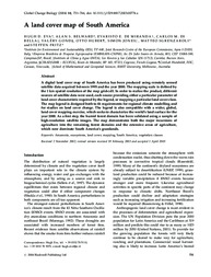
A land cover map of South America.
A land cover map of South America.
Autoria: EVA, H. D.; BELWARD, A. D.; MIRANDA, E. E. de; DI BELLA, C. M.; GONDS, V.; HUBER, O.; JONES, S.; SGRENZAROLI, M.; FRITZ, S.
Resumo: A digital land cover map of South America has been produced using remotely sensed satellite data acquired between 1995 and the year 2000. The mapping scale is defined by the 1 km spatial resolution of the map grid-cell. In order to realize the product, different sources of satellite data were used, each source providing either a particular parameter of land cover characteristic required by the legend, or mapping a particular land cover class. The map legend is designed both to fit requirements for regional climate modelling and for studies on land cover change. The legend is also compatible with a wider, global, land cover mapping exercise, which seeks to characterize the world?s land surface for the year 2000. As a first step, the humid forest domain has been validated using a sample of high-resolution satellite images. The map demonstrates both the major incursions of agriculture into the remaining forest domains and the extensive areas of agriculture, which now dominate South America?s grasslands.
Ano de publicação: 2004
Tipo de publicação: Artigo de periódico
Unidade: Embrapa Territorial
Palavras-chave: Amazonia, Ecosystems, Land cover, Mapping, South America, Vegetation classes
Observações
1 - Por padrão são exibidas publicações dos últimos 20 anos. Para encontrar publicações mais antigas, configure o filtro ano de publicação, colocando o ano a partir do qual você deseja encontrar publicações. O filtro está na coluna da esquerda na busca acima.
2 - Para ler algumas publicações da Embrapa (apenas as que estão em formato ePub), é necessário ter, no celular ou computador, um desses softwares gratuitos. Sistemas Android: Google Play Livros; IOS: iBooks; Windows e Linux: software Calibre.
Acesse outras publicações
Acesse a Base de Dados da Pesquisa Agropecuária (BDPA) para consultar o acervo completo das bibliotecas da Embrapa.