General Search | Content Related to Rural Environmental Registry (CAR): Territorial dimension of areas intended for the conservation of native vegetation in rural properties
Related content

Adequação ambiental e restauração ecológica
Unidade de Referência Tecnológica (URT) com métodos de RED para proteção e restauração de nascentes no Bioma Mata Atlântica. Mostra a adequação ambiental em Área de Preservação Permanente (APP) em pro ...
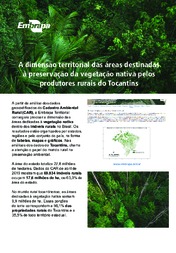
As áreas dedicadas à preservação da vegetação nativa pelo mundo rural brasileiro somam 282,8 milhões de hectares e representam 33,2% do território brasileiro. Os números vêm de um...
Publishing date: 25/10/21
Se fossem cultivadas com milho, as áreas de reserva legal do Oeste da Bahia teriam gerado R$ 6,5 bilhões em 2017. O cálculo foi feito pela Embrapa Territorial (Campinas, SP), por...
Publishing date: 17/12/18
Os dados de novas inserções de imóveis ao Sistema Nacional de Cadastro Ambiental Rural (SiCAR), ao longo de um ano, revelaram que a participação do setor rural brasileiro na...
Publishing date: 24/07/18
Cálculos do Grupo de Inteligência Territorial Estratégica (Gite) da Embrapa, a partir das análises de dados geocodificados do Cadastro Ambiental Rural (CAR), mostram significativa...
Publishing date: 13/06/17
*Content only available in Portuguese
Por meio deste projeto, a Embrapa Territorial e a Empresa de Assistência Técnica e Extensão Rural do Estado de Minas Gerais (Emater-MG) estabelecem colaboração para promover o uso de ferramentas de inteligência territorial estratégica no planejamento e execução de assistência técnica e extensão rural. Para tanto, são oferecidas ao corpo técnico da instituição mineira capacitação no uso de quatro plataformas de dados espaciais desenvolvidas pelo centro de pesquisa: GeoWeb Inclusão Produtiva em se ...
Status: Completed Start date: Wed Jul 01 00:00:00 GMT-03:00 2020
Using the data declared by the farmers in the Brazilian Rural Environmental Registry (CAR) maintained by the Brazilian Forest System, this project intends to analyze areas destined for the preservation of native vegetation in rural properties, and legally assigned areas. This analysis is focused on a delimited territory (the State of Rondônia) and performed at increasing, successive levels, city > microregion > and the state of Rondônia, as requested by the Soybean Producers Association in Rondô ...
Status: Completed Start date: Sun Sep 01 00:00:00 GMT-03:00 2019
This project aimed to measure the area dedicated to the preservation of native vegetation inside rural properties in the state of Piauí. Based on a territorial section (state of Piauí) and the data declared in the Rural Environmental Registry (CAR), available in the Rural Environmental Registry System of the Ministry of the Environment (SICAR), an analysis of the territorial context of the areas dedicated to the preservation of native vegetation in rural areas was carried out using increasing an ...
Status: Completed Start date: Sat Jun 01 00:00:00 GMT-03:00 2019
The objective of this project is to structure a Strategic Territorial Management System for the Brazilian Cerrado (SGTE-Cerrados), with emphasis on the Rural Environmental Registry (CAR), seeking to systematize information, characterize, monitor indicators and perform periodic analyzes that allow an adequate understanding of the agricultural use and occupation of the biome in its territorial, economic, social and environmental dimensions. The importance of this project is in the generation of st
Status: Completed Start date: Sun Jul 01 00:00:00 GMT-03:00 2018