General Search | Content Related to GeoInfo - Management Model for Embrapa's Geospatial Information
Related content
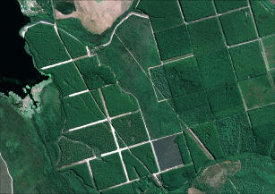
Imagem de Satélite
By: GEOEYE, Embrapa
Recortes de imagens do satélite GeoEye, produzidas pela Embrapa Monitoramento por Satélite, para uso em projetos de pesquisa da Unidade.
A Infraestrutura Nacional de Dados Espaciais (Inde) e o modelo de gestão da informação geoespacial da Embrapa foram os temas do seminário e workshop promovido pela Embrapa...
Publishing date: 02/10/14
A Embrapa Monitoramento por Satélite, Unidade da Empresa Brasileira de Pesquisa Agropecuária (Embrapa), promove, no dia 24 de setembro, o "Seminário sobre a Infraestrutura Nacional...
Publishing date: 16/09/14
Especialistas em geotecnologia estarão reunidos de 7 a 9 de maio no Centro de Convenções Frei Caneca, em São Paulo (SP), para o MundoGEO#Connect 2014, considerado o maior evento da...
Publishing date: 06/05/14
Geoinfo is a digital platform that stores, organizes and shares geospatial data generated by Embrapa1s research. As a a member of the National Spatial Data Infrastructure (INDE, from the acronym in Po
Methodology: Computerized procedure Launch year: 2024 Responsible Unit: Embrapa Territorial
Maps, zoning and monitoring resources are examples of geospatial information which are daily used for planning, managing resources, decision making, and for public policies. Geoinformation are of strategic importance for several sectors, including for strengthening Brazilian agriculture and for transferring the knowledge produced by Embrapa to society. To quickly produce, organize and make geospatial services and data available, Embrapa needed an up-to-date, modern data infrastructure, to ena
...Status: Completed Start date: Sun Feb 01 00:00:00 GMT-03:00 2015
This project arose from the need to generate and consolidate geospatial databases, implementing an infrastructure in order to organize and make this data available to improve Embrapa's RD&I capacity. As well as to allow sharing of the data collection to other government agencies and to society, and also the establishment of a multiuser reference center for obtaining spectroradiometric measurements of targets of interest to tropical agriculture. The implementation of Embrapa's Spatial Data Infras ...
Status: Completed Start date: Sun Jun 01 00:00:00 GMT-03:00 2014
Author(s): MAGNUSSON, W.; BRAGA-NETO, R.; PEZZINI, F.; BACCARO, F.; BERGALLO, H.; PENHA, J.; RODRIGUES, D.; VERDADE, L. M.; LIMA, A.; ALBERNAZ, A. L.; HERO, J-M.; LAWSON, B.; CASTILHO, C.; DRUCKER, D. P.; FRANKLIN, E.; MENDONÇA, F.; COSTA, F.; GALDINO, G.; CASTLEY, G.; ZUANON, J.; VALE, J. DO; SANTOS, J. L. C. DOS; LUIZÃO, R.; CINTRA, R.; BARBOSA, R. I.; LISBOA, A.; KOBLITZ, R. V.; CUNHA, C. N. DA; PONTES, A. R. M.


