New partnership will map agroforestry systems and perennial crops in the Amazon
New partnership will map agroforestry systems and perennial crops in the Amazon
Establishing a service to map Agroforestry Systems and perennial agriculture in the Brazilian state of Pará is the goal of a partnership that Embrapa Eastern Amazon has just signed with the program Servir-Amazonia. The program comprises cutting-edge geoespacial technology that will be applied in the region to support decision making by city governments, institutions and local communities.
With the use of satellite information and geotechnologies, combined with field validation, it will be possible to establish land cover standards to generate pilot maps that will show the presence of AFSs and cacao, African palm oil, açaí and citrus crops in different regions of Pará.
The work, which is initially due to last two years, is going to take place in nine villages in Pará state: Acará, Moju, Tomé-Açu, Altamira, Brasil Novo, Medicilândia, Igarapé-Açu, Capitão Poço, and Castanhal, which feature African palm oil, cacao, and açaí crops and integrated production systems. It will generate a permanent offer of products and services about perennial agriculture in those villages based on the use of public images and the training of local teams.
International consortiumServir-Amazonia is a consortium promoted by the United States National Aeronautics and Space Administration (NASA) and the United States Agency for International Development (USAID), which is conducted by the Alliance of Bioversity International and the International Center for Tropical Agriculture (CIAT), and whose members include the Institute of Agricultural and Forest Management and Certification (IMAFLORA) in Brazil, U.S.-based Spatial Informatics Group (SIG), the Association for the Conservation of the Amazonian Basin (ACCA) in Peru, and the EcoCiência Foundation in Colombia. The program aims to use satellite information and geospatial technologies to generate products and services to improve environmental decision-making in the region. Covering Brazil, Peru, Colombia, Ecuador, Guyana and Suriname, the program started in 2019, and integrates Servir-Global. |
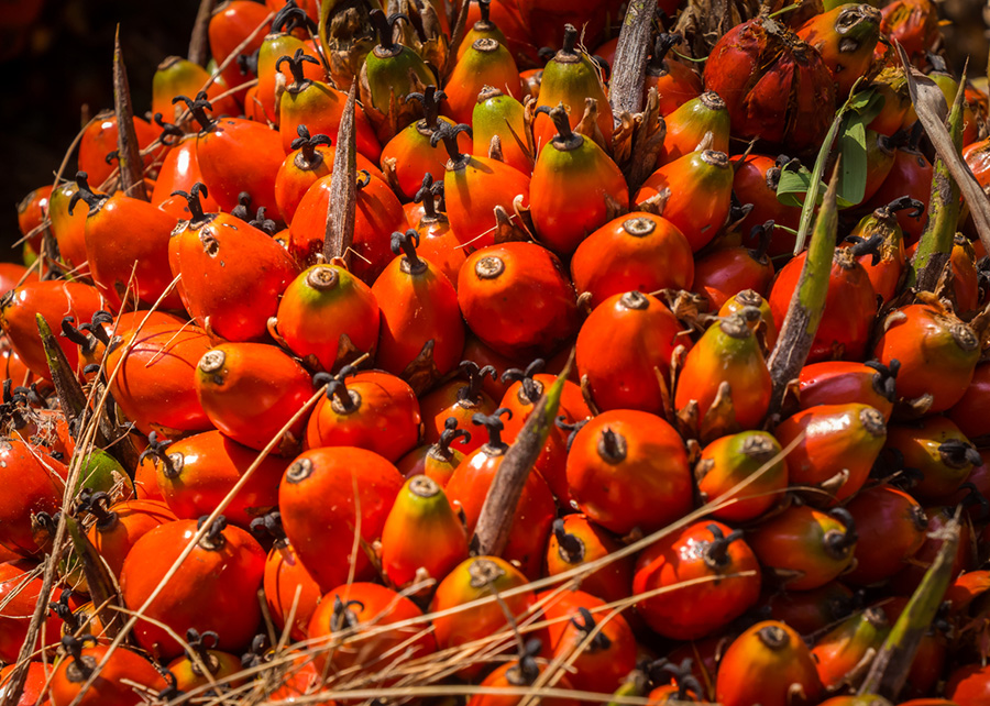
ProductionPará state is the largest producer of cacao, African palm oil and açaí in Brazil. In 2019, according to data (Agricultural Production per city) by IBGE (Brazilian Institute of Geography and Statistics), the state produced 2,543,000 tons of African oil palm bunches, 129,000 tons of cacao almonds and 1,400,000 tons of açaí palm berries. With regard to national production, the state is responsible for 98% of the African palm oil, 49% of the cacao, and 95% of the açaí produced in the country. |
The Head of Embrapa Eastern Amazon, Adriano Venturieri, explains that the aim of the work is to bridge information gaps and improve land use and cover ongoing monitoring systems in the Amazon like TerraClass and MapCacau, initiatives led by Embrapa in the Amazon region.
“We have difficulties in mapping cacao, which can often be mistaken with thickets (secondary vegetation)”, he exemplifies. Moreover, it is generally cultivated under forest fragments or within crop systems. “And the optic sensors currently in use do not detail this difference. Then, practically all of the mapping is performed in the field”, he explains.
The idea, according to the executive, is to combine imaging by more precise sensors with field validations to develop land cover classification algorithms and thus automate mapping. “The work generates information that directly contributes to the elaboration of public policy aimed at the agricultural development of the region, which includes climate, ecological-economic risk; environmental and other kinds of zoning”, Venturieri affirms.
More precise images
The technical coordinator of the study, Naiara Pinto, a Brazilian ecologist and member of the Radar Division of NASA's Jet Propulsion Laboratory in Pasadena, California, explains that the work of mapping will use public satellite images by NASA and European and Japanese space agencies.
The differential, according to the expert, is the use of active sensors to characterize the interface between agriculture and forest. Those sensors produce their own signal - in contrast with passive sensors that depend on solar radiation - and therefore they have more penetration under the surface of the Earth and can thus observe the soil cover with more accuracy.
The landscape ecologist clarifies that active sensors are not a novelty in forest observation, but “it is only now that it will be possible to operacionalize the service and systematically make the land cover classification”, she asserts. With more accurate photographs and the connection with the field data, it will be possible to adjust the satellite signal for the presence of the AFSs and perennial crops, based on canopy shape and other specific information. “That is how it will be possible to implement a model of land cover classification in the studied region”, she adds.
Co-development of products and services
The collaborative joint development of the service to map AFSs and perennial crops in Pará, which is performed by local and external specialists, is the foundation for the Servir-Amazonia. José Leandro Fernandes, who is the leader of User Engagement in the program, explains that the work has two targets: the co-development of technology services; and meeting requests on demand.
“There is a whole process to bring users to the service. The idea is to guarantee local internal capacity to responde to the challenges of the region”, Fernandes reports.
The expert explains that the partnership will provide more sophisticated geospatial information at city and community level, which can support local assertions and decision making, and also strengthen environmental monitoring tools.
Ana Laura Lima (MTb 1268/PA)
Embrapa Eastern Amazon
Press inquiries
amazonia-oriental.imprensa@embrapa.br
Phone number: +55 91 99110-5115
Mariana Medeiros (Translation - English)
General Secretariat
Further information on the topic
Citizen Attention Service (SAC)
www.embrapa.br/contact-us/sac/


