Model estimates impact of investments in agricultural logistics
Model estimates impact of investments in agricultural logistics
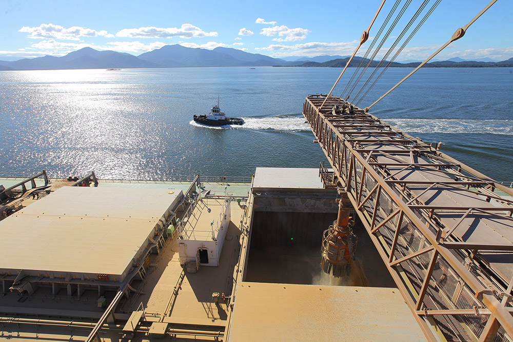
Photo: André KasczeszenAppa / Porto de Paranaguá

The method assesses the economic feasibility of transporting bulk cargoes such as agricultural products, ore, fertilizers, etc to a given port
A mathematical model to estimate changes in ports' areas of influence due to the implementation of new transportation infrastructure was developed by Embrapa Territorial, Unicamp and the Federal University of Minas Gerais. The area of influence indicates the range of the territory from which it is feasible to transport cargo to a given port for imports and exports. That is also called hinterland or logistic basin.
The unprecedented method can be used to anticipate scenarios, assess long-term projects and public policy, and inform players (port operators, logistics operators, tradings, etc.) in the exports chain in their investments. It assesses the economic feasibility of transporting bulk cargoes such as agricultural products, ore, fertilizers, etc to a given port.
For this purpose, it uses three variables: freight cost, distance and slope in the assessed routes. It is possible, however, to add other analysis factors, as long as they have a spatial component, that is, they consider their location in the territory. “You can put in all the existing logistics projects in Brazil and see what happens with the configuration of the area of influence of Brazilian ports,” explains agricultural and environmental engineer Marlon Fernandes de Souza, one of the authors of the study.
Published in the Journal of Transport Geography (impact factor: 5,899), the method was inspired by the concept of logistics basins developed by Embrapa Territorial and applied in the Strategic Territorial Intelligence System of Agricultural Macrologistics (SITE-MLog) for the grains chain. In this case, the analysis considers what has already effectively happened, based on data on city grain production and the identification of the origin of the products and their destination ports.
The delimitation of the grain logistics basins available in SITE-MLog was used to validate the new model. The article published in the Journal of Transport Geography presents such validation study with the indication of the port with the lowest cost for transporting products from each region. Souza points out that more than one port can be economically viable, generating overlaps between areas of influence. The model allows the identification of regions in which each is the most competitive, which is particularly interesting in the South and Southeast regions of Brazil, where the ports are closer to each other.
“We have created a dynamic port regionalization that can be expanded to other products, and incorporate new logistics projects and transportation corridors, in order to assess the impact on the port sector. Investment strategies for Brazilian logistics can now count on another methodology for feasibility analysis from an economic and environmental point of view,” says Professor Andréa Leda Ramos de Oliveira, coordinator of the Laboratory of Research in Agroindustrial Logistics and Trade at Unicamp (Logicom).
Cost and other factors
Gustavo Spadotti, head of Embrapa Territorial, explains that the idea of building a mathematical model started with the team reflecting on the logistics basins: “Are the logistics basins that are practiced today in accordance with cost basins? Our hypothesis is that they would be the same or similar because the cargoes would have traveled the lower cost routes.” Once the model was built and applied, it was observed that, in some situations, other factors have a higher influence than cost. Contracts signed, operators and trading companies present in the terminals are some of these factors.
For Spadotti, one of the main applications of the model is to guide the prioritization of contruction works and other investments. “You need to have a value assigned to such routes to know if the impact of new routes will be positive for the flow of harvested crops and to reduce the so-called 'Brazil cost',” he says. Not only roads and railways can change the preferred paths to ports. “When one could fill containers with cotton before reaching the ports or large urban centers, as is happening now in Western Bahia, they started to create a new logistics route from new points,” he said.
The paper with the methodology for the mathematical model also shows an analysis of what would be the expansion of the area of influence of the Vila do Conde Port as Ferrogrão, a railway that will connect Sinop-MT to Itaituba-PA, starts operations. The area would have an increase of 57 to 80 municipalities, depending on environmental restrictions to be defined.
Click here to read the publication.
Vivian Chies (MTb 42.643/SP)
Embrapa Territorial
Press inquiries
territorial.imprensa@embrapa.br
Phone number: +55 19 3211-6200
Translation: Mariana Medeiros (13044/DF)
Superintendency of Communications
Further information on the topic
Citizen Attention Service (SAC)
www.embrapa.br/contact-us/sac/


