Matopiba Strategic Territorial Intelligence System – technological improvement and development for mobile access
Matopiba Strategic Territorial Intelligence System – technological improvement and development for mobile access

Photo: EMBRAPA, Monitoramento por Satélite
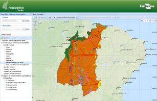
The objective of this project was the improvement the web platform (GeoWeb Matopiba) and the development of an interface for mobile access to the data of the Strategic Territorial Intelligence System (SITE) Matopiba, with features to allow integrated analysis between data layers. The SITE Matopiba is the result of the special Project called “Embrapa's Strategic Action Plan in the Matopiba region”, which established the Company's strategic guidelines for operations in the region. The project included the development of a web interface (GeoWeb Matopiba) to provide maps and data generated in an interactive and integrated way. However, in addition to the constant technological update inherent to any software development process, the need to incorporate navigation, consultation, analysis and collaboration mechanisms to the various information plans generated by the project became evident. In addition, the need for a customized interface for mobile devices was also evident. The project aimed to meet these demands.
Status: Completed Start date: Tue Jan 01 00:00:00 GMT-03:00 2019 Conclusion date: Tue Dec 31 00:00:00 GMT-03:00 2019
Head Unit: Embrapa Territorial
Project leader: Luciola Alves Magalhaes
Contact: luciola.magalhaes@embrapa.br

