Qualisolo - Spatial Variability in Soil Quality Rates in Agricultural Systems
Qualisolo - Spatial Variability in Soil Quality Rates in Agricultural Systems

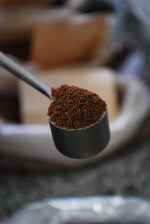
Photo: MEDEIROS, Daniel
Soil quality may be measured through the use of indicators, which are attributes that measure or reflect the environmental state or condition of sustainability of the referred ecosystem. The knowledge regarding the spatial distribution of soil quality and its levels becomes essential in this case, once it favors the study of their relation with the type of soil management, with the environmental impact and the productive capability of agricultural systems. For such, it is important to have a method which investigates, spatially and collectively, the soil's attributes (chemical, physical and biological), in order to obtain their quality indicators in agricultural systems. Considering the spatial distribution of these attributes in observation areas, it is assumed that these are dependant of various factors, a fact which is widely observed in studies involving the sciences of the soil. Geostatistical analysis developed in this project incorporates the relationships between geospatial data in the form of correlation between the sampled areas, based on the hypothesis that samples which are closer to each other are more alike than samples between more distant areas. Three are the studied areas, in which are found three distinct agricultural systems: soy, sugarcane and grasslands (Brachiaria sp.). The knowledge on spatial distribution of these quality indicators makes it much easier to study their relationships with the required management type, the impacts on the environment and the productive capability of agricultural systems. The knowledge on methods and the validation of indicators of soil quality's spatial distribution and their relationships in agro-energy systems help the optimization of most adequate management, and minimizes the environmental degradation impacts, as well as in the choice of soil management which makes it most productive. The project's goal was to develop a system based in quantitative and multi-criteria methods which would obtain soil quality indicators (physical, chemical and biological), considering spatial variability in agricultural productive systems. As a result, a scientific method was developed, by means of which soil quality indicators were calculated and their maps were traced, by means of interpolation between soil quality indicators and their production in agricultural systems. For more information, access: http:// http://www.cnpm.embrapa.br/projetos/qualisolo
Ecosystem: Cerrados Region
Status: Completed Start date: Tue Sep 01 00:00:00 GMT-03:00 2009 Conclusion date: Wed Aug 31 00:00:00 GMT-03:00 2011

