Hydrojipa - Hydrologic Modeling and Orbital Sensors in Studies of Impacts Arisen as a Consequence of Changes in Soil Usage and Vegetal Covering and its Effects on Hydric Availability at Bacia do Rio Ji-Paraná, RO
Hydrojipa - Hydrologic Modeling and Orbital Sensors in Studies of Impacts Arisen as a Consequence of Changes in Soil Usage and Vegetal Covering and its Effects on Hydric Availability at Bacia do Rio Ji-Paraná, RO

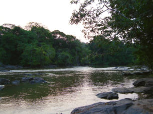
Photo: GALINARI, Graziella
There is currently a strong interest to comprehend, evaluate and minimize anthropic impacts on hydric resources. It has been particularly studied the effect of removing native vegetal covering over water availability and quality. In order to estimate the effects of changing vegetal covering over hydric resources, hydrologic modeling becomes an adequate tool. However, hydrologic models need great amounts of information, which in most times are unavailable. On the other hand, data obtained through remote sensing have shown to be very useful for being capable of offering information on extended areas, and of difficult access, such as is the amazonian region. This project will incorporate data from orbital sensors (precipitation, temperature, vegetation levels etc.) in hydrologic modeling of Bacia do Rio Ji-Paraná, in order to evaluate limitations and opportunities of this approach in studies of impacts arisen as a consequence of changes in land usage and vegetal covering over hydric availability. This project aims to evaluate the benefits and difficulties in incorporating orbital sensing data in hydrologic modeling, as a way to estimate impacts arisen as a consequence of changes in soil covering over hydric availability in the Amazon. For such a purpose, the hydrologic model used was the MGB-IPH, with data obtained in weather stations and orbital remote sensors. The SEBAL algorithm was also evaluated, it estimates energy fluxes from remote sensing data. Both methods will be compared in order to evaluate the possibility of integrating them. As a result, the hopes are to obtain a hydrometeorological information database of the studied basin, in addition to a calibrated hydrologic model for the region. The substitution of data originated from local weather stations with data from remote sensing systems will also be tested. Finally, comparisons between simulated results from two different models of the region will be done. More information, access: http://www.cnpm.embrapa.br/projetos/hidrojipa
Ecosystem: Amazonic
Status: Completed Start date: Wed Sep 01 00:00:00 GMT-03:00 2010 Conclusion date: Thu Feb 28 00:00:00 GMT-03:00 2013
Head Unit: Embrapa Territorial
Project leader: Daniel de Castro Victoria
Contact: daniel.victoria@embrapa.br


