Search Publications
Filter by:
| Author(s): BRANDÃO, Z. N.; GREGO, C. R.; GONDIM, T. M. de S.; RODRIGUES, H. M. Satellite images are valuable tools to assess the nutritional status of plants and, thus, understand the variability of cotton yield in farmers' fields. By identifying soil variability and nutritional... ... |
| Author(s): SPERANZA, E. A.; QUEIROS, L. R.; RABELLO, L. M.; GREGO, C. R.; BRANDÃO, Z. N. Resumo: Este trabalho descreve a implantação de uma ferramenta para armazenamento em uma base de dados espacial de informações georreferenciadas de condutividade elétrica do solo obtidas em campo. A p... ... |
| Author(s): MACARIO, C. G. N.; SANTOS, J. A. dos; MEDEIROS, C. B.; TORRES, R. da S. Georeferenced data are a key factor in many decision-making systems. However, their interpretation is user and context dependent so that, for each situation, data analysts have to interpret them, a ti... ... |
| |
| Author(s): TAVARES, R. L. M.; OLIVEIRA, S. R. de M.; BARROS, F. M. M. de; FARHATE, C. V. V.; SOUZA, Z. M. de; LA SCALA JUNIOR, N. ABSTRACT: The Random Forest algorithm is a data mining technique used for classifying attributes in order of importance to explain the variation in an attribute-target, as soil CO2 flux. This study ai... ... |
| Author(s): SILVA, C. C. da; OLIVEIRA, S. R. de M.; ADAMI, S. F.; CRIVELENTI, R. C.; COELHO, R. M. ABSTRACT: The study had as objective to develop techniques for digital soil mapping with support of main parameters of relief descriptors, of geologic map and pedological map pre-existing of Dois Córr... ... |
| Author(s): MEZA, L. A.; GOMES, E. G.; MELLO, J. C. C. B. S. de; BIONDI NETO, L.
|
| Author(s): BIONDI NETO, L.; MELLO, J. C. C. B. S. de; MEZA, L. A.; GOMES, E. G. Interval DEA frontiers are here used in situation where one input or output is subject to uncertainty in its measurement and is presented as an interval data. We built an efficient frontier without an... ... |
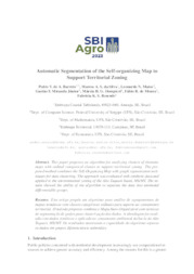
| Author(s): BARRETO, P. V. DE A.; SILVA, M. A. S. da; MATOS, L. N.; MIRANDA JÚNIOR, G. F.; DOMPIERI, M. H. G.; MOURA, F. R. DE; RESENDE, F. K. S. ABSTRACT: This paper proposes an algorithm for analyzing clusters of thematic maps with ordinal categorical classes to support territorial zoning. The proposed method combines the Self-Organizing Map... ... |
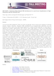
| Author(s): MARTINS, V.; KALEITA, A. L.; GELDER, B. K.; SILVEIRA, H. L. F. da; ABE, C. A.
|
Observation
Some of Embrapa's publications are published as ePub files. To read them, use or download one of the following free software options to your computer or mobile device. Android: Google Play Books; IOS: iBooks; Windows and Linux: Calibre.
Access other publications
Access the Agricultural Research Database (BDPA) to consult Embrapa's full library collection and records.
Visit Embrapa Bookstore to purchase books and other publications sold by Embrapa.

