Search Publications
Filter by:
| Author(s): CRUZ, S. A. B. da; SILVA, J. dos S. V. da Resumo. Estudos envolvendo dados geoespaciais da região do Pantanal representam desafios de interoperabilidade que podem ser mais facilmente superados com a adoção do modelo orientado à serviços espec... ... |
| Author(s): DRUCKER, D. P.; PINTO, D. M.; FIDALGO, E. C. C.; CUSTODIO, D. de O.; VICTORIA, D. de C.; ALMEIDA, B. T. de; PIEROZZI JUNIOR, I.; MACHADO, C. R. de L.; SANTOS, V. V. dos; SILVA, G. B. S. da; LAFORET, M. R. C.; TAKEMURA, C. M.; OLIVEIRA, L. H. M. de We describe our effort on building a Spatial Data Infrastructure (SDI) at Embrapa, the Brazilian Agricultural Research Corporation, a networked public company composed by 46 research centers distribut... ... |
| Author(s): DRUCKER, D. P.; PINTO, D. M.; FIDALGO, E. C. C.; CUSTÓDIO, D. de O.; VICTORIA, D. de C.; ALMEIDA, B. T. de; SIMÕES, M.; MACHADO, C. R. de L.; SANTOS, V. V. dos; DART, R. de O.; AGLIO, M. L. D.; RASCHE, F.; LAFORET, M. R. C.; BETTIOL, G. M.; PEREIRA, S. E. M.; BRANDÃO, Z. N.; GARRASTAZU, M. C.; FILIPPINI ALBA, J. M.; COSTA, F. A. da; TORRES, R. C.; DOMPIERI, M. H. G.; SAMPAIO, S. M. N.; MARTINS, E. C.; PIEROZZI JUNIOR, I.; SILVA, G. B. S. da; GALINARI, G.; FIORINI, F. B.; TAKEMURA, C. M.; CRUZ, S. A. B. da; HOLLER, W. A.; OLIVEIRA, L. H. M. de Resumo. A geoinformação é essencial para o planejamento e monitoramento das atividades agropecuárias, justificando o emprego de esforços para reuni-la e padronizá-la de acordo com as diretrizes govern... ... |
| Author(s): SPERANZA, E. A.; SILVA, J. dos S. V. da; BOSCHINI, M. L.; SOUZA, L. A. de Resumo: Este artigo descreve as metodologias, padrões e softwares utilizados para a catalogação dos metadados geoespaciais de dados temáticos de Mato Grosso do Sul, no intuito de atender aos pré-requi... ... |
| |
| Author(s): BETTIOL, G. M.; MOURA, L.; NOGUEIRA, S. F.; DRUCKER, D. P.; OLIVEIRA, P. P. A.; QUARTAROLI, C. F.; RODRIGUES, C. A. G.; SILVA, G. B. S. da The aim of this article is to describe and report how the GeoPECUS project is using the standards and rules established by the Brazilian National SDI to publish and organize the geospatial data produc... ... |
| |
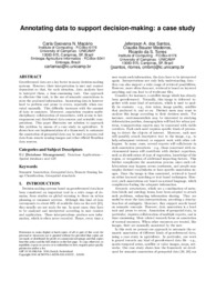
| Author(s): MACARIO, C. G. N.; SANTOS, J. A. dos; MEDEIROS, C. B.; TORRES, R. da S. Georeferenced data are a key factor in many decision-making systems. However, their interpretation is user and context dependent so that, for each situation, data analysts have to interpret them, a ti... ... |
| Author(s): SANTOS, J. L. dos; SILVA, J. dos S. V. da; MENGATTO JUNIOR, E. A.; ANDRADE, D. D. de; FIGUEIREDO, V. A. O crédito rural no Brasil é utilizado como um importante instrumento para estimular o desenvolvimento da produção agrícola brasileira e o Governo Federal tem alocado a cada ano mais recursos no intuit... ... |
| Author(s): RODRIGUES, F. C.; PEREIRA, S. E. M.; MANZATTO, C. V.; ARAUJO, L. S. de Resumo: Este trabalho tem por objetivo analisar metadados geoespaciais de dados geoepaciais coletados em ambiente web. Além disso, busca descrever seus atributos, exclusivamente, a partir do site de o... ... |
Observation
Some of Embrapa's publications are published as ePub files. To read them, use or download one of the following free software options to your computer or mobile device. Android: Google Play Books; IOS: iBooks; Windows and Linux: Calibre.
Access other publications
Access the Agricultural Research Database (BDPA) to consult Embrapa's full library collection and records.
Visit Embrapa Bookstore to purchase books and other publications sold by Embrapa.

