Search Publications
Filter by:
| Author(s): MEYER, V.; SAATCHI, S.; CLARCK, D. B.; KELLER, M.; VICENT, G.; FERRAZ, A.; ESPÍRITO-SANTO, F.; OLIVEIRA, M. V. N. d'; KAKI, D.; CHAVE, J. Large tropical trees store significant amounts of carbon in woody components and their distribution plays an important role in forest carbon stocks and dynamics. Here, we explore the Properties of a n... ... |
| Author(s): PAPA, D. de A.; FIGUEIREDO, E. O.; CAMARGO, A. P.; RODRIGUEZ, L. C. E. Entre os métodos de extração madeireira a Exploração de Impacto Reduzido (EIR) é a que traz maiores benefícios financeiros ao produtor e ao meio ambiente principalmente devido ao uso de técnicas de pl... ... |
| |
| Author(s): BISWAS, A.; ANDRADE, M. H. M. L.; ACHARYA, J. P.; SOUZA, C. L. de; LOPEZ, Y.; ASSIS, G. M. L. de; SHIRBHATE, S.; SINGH, A.; MUNOZ, P.; RIOS, E. F. The application of remote sensing in plant breeding is becoming a routine method for fast and non-destructive high-throughput phenotyping (HTP) using unmanned aerial vehicles (UAVs) equipped with sens... ... |
| Author(s): SANTOS, C. A. N. dos; PAPA, D. de A.; PRADO, L. dos S.; FIGUEIREDO, E. O.; FERREIRA, E. J. L. No manejo florestal da Amazônia, o inventário florestal de campo é uma atividade onerosa, de difícil execução e sujeita a falhas. A aplicação das geotecnologias nas atividades florestais vem sendo pri... ... |
| Author(s): OLIVEIRA, M. V. N. d'; FIGUEIREDO, E. O.; PAPA, D. de A.; PANTOJA, N. The objective of this work was to optimize the design of the Annual Production Units (APU) in forest management plans, through the combination of field and remote sensing data. |
| Author(s): OLIVEIRA, M. V. N. d'; LOCKS, C. J. Neste trabalho apresentamos uma comparação entre modelos digitais de terreno (MDT), de superfície e de altura (MDA) produzidos a partir de dados LiDAR e SAR aerotransportado, e verificamos a possibili... ... |
| Author(s): PANTOJA, N.; BEUCHLE, R.; OLIVEIRA, M. V. N. d'; CASSOL, H.; LUI, G. This work presents a approach for monitoring forest degradation in the Brazilian Amazon using a multi-temporal dataset of Landsat-8 imagery. We use a Normalized Burned Ratio (NBR) for detecting select... ... |
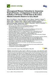
| Author(s): OLIVEIRA, M. V. N. d'; BROADBENT, E. N.; OLIVEIRA, L. C. de; ALMEIDA, D. R. A.; PAPA, D. de A.; FERREIRA, M. E.; ZAMBRANO, A. M. A.; SILVA, C. A.; AVINO, F. S.; PRATA, G. A.; MELLO, R. A.; FIGUEIREDO, E. O.; JORGE, L. A. de C.; JUNIOR, L.; ALBUQUERQUE, R. W.; BRANCALION, P. H. S.; WILKINSON, B.; COSTA, M. O. da Tropical forests are often located in dicult-to-access areas, which make high-quality forest structure information dicult and expensive to obtain by traditional field-based approaches. LiDAR (acronym... ... |
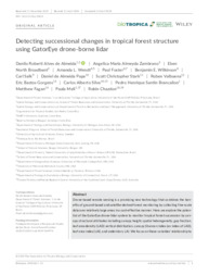
| Author(s): ALMEIDA, D. R. A. de; ZAMBRANO, A. M. A.; BROADBENT, E. N.; WENDT, A. L.; FOSTER, P.; WILKINSON, B. E.; SALK, C.; PAPA, D. de A.; STARK, S. C.; VALBUENA, R.; GORGENS, E. B.; SILVA, C. A.; BRANCALION, P. H. S.; FAGAN, M.; MELI, P.; CHAZDON, R. Drone-based remote sensing is a promising new technology that combines the benefits of ground-based and satellite-derived forest monitoring by collecting fine-scale data over relatively large areas in... ... |
Observation
Some of Embrapa's publications are published as ePub files. To read them, use or download one of the following free software options to your computer or mobile device. Android: Google Play Books; IOS: iBooks; Windows and Linux: Calibre.
Access other publications
Access the Agricultural Research Database (BDPA) to consult Embrapa's full library collection and records.
Visit Embrapa Bookstore to purchase books and other publications sold by Embrapa.

