Search Publications
Filter by:
| Author(s): FERNANDES, P. B.; CARVALHO, C. A. B. DE; PACIULLO, D. S. C.; GOMIDE, C. A. de M.; LIMA, K. R. DE; LEDO, F. J. da S.
|
| Author(s): BRANDAO, Z. N.; GREGO, C. R.; ZONTA, J. H. O objetivo deste trabalho foi avaliar a capacidade de índices de vegetação obtidos através de imagens do satélite Sentinel-2, por imagens aéreas de alta resolução e imagens RGB obtidas em VANTs, na es... ... |
| Author(s): LOUREIRO, H. A. S.; GUERRA, A. J. T.; ANDRADE, A. G. de A pesquisa aplicada em Geomorfologia envolve coleta e análise de dados e se insere no planejamento, manejo e decisão sobre ocupação, produção, recreação e conservação. Nesse sentido, o uso de geotecno... ... |
| Author(s): ALMEIDA, D. R. A. de; ZAMBRANO, A. M. A.; BROADBENT, E. N.; WENDT, A. L.; FOSTER, P.; WILKINSON, B. E.; SALK, C.; PAPA, D. de A.; STARK, S. C.; VALBUENA, R.; GORGENS, E. B.; SILVA, C. A.; BRANCALION, P. H. S.; FAGAN, M.; MELI, P.; CHAZDON, R. Drone-based remote sensing is a promising new technology that combines the benefits of ground-based and satellite-derived forest monitoring by collecting fine-scale data over relatively large areas in... ... |
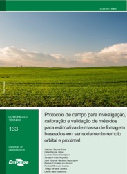
| Author(s): SILVA, G. B. S. da; GREGO, C. R.; KOENIGKAN, L. V.; NOGUEIRA, S. F.; PEZZOPANE, J. R. M.; SANTOS, R. C. dos; SANTOS, P. M.; SANTOS, T. T.; TAKEMURA, C. M. Neste trabalho, apresentamos um protocolo de campo para o levantamento de dados necessários ao desenvolvimento de metodologias para estimativa de massa de forragem a partir de sensoriamento remoto orb... ... |
| |
| Author(s): BRÚSSOLO, R. G.; PEZZOPANE, J. R. M.; VECCHIA, F. A. da A Radiossondagem de sub-altitude tem como objetivo mensurar os dados climatológicos em vários níveis verticais da atmosfera por meio de um equipamento denominado radiossonda. Além do mais, é conhecido... ... |
| |
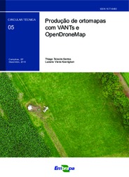
| Author(s): LUCHIARI JUNIOR, A.; RODRIGUES, G. C.; CAMARGO NETO, J.; SILVA, F. C. da; JORGE, L. A. de C. Considerando o crescente uso de imagens aéreas digitais obtidas por veículos aéreos não tripulados (Vants), o presente trabalho tem por propósito obter e analisar imagens digitais REG obtidas por câme... ... |
| |
Observation
Some of Embrapa's publications are published as ePub files. To read them, use or download one of the following free software options to your computer or mobile device. Android: Google Play Books; IOS: iBooks; Windows and Linux: Calibre.
Access other publications
Access the Agricultural Research Database (BDPA) to consult Embrapa's full library collection and records.
Visit Embrapa Bookstore to purchase books and other publications sold by Embrapa.

