Strategic Territorial Intelligence System (SITE) for the Sustainable Development of Agriculture in Brazilian Caatinga Biome
Strategic Territorial Intelligence System (SITE) for the Sustainable Development of Agriculture in Brazilian Caatinga Biome

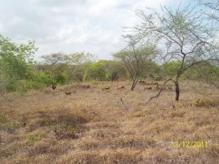
Photo: FERNANDES, Francisco Eden Paiva
The objective of this project is to structure a Strategic Territorial Intelligence System (SITE, Sistema de Inteligência Territorial Estratégica in Portuguese) to support the sustainable development of agriculture within the Brazilian Caatinga biome. A SITE’s design, construction and operation is based on a broad and strict methodological procedure for organizing georeferenced and analytical information of five dimensions: natural, agrarian, agricultural, infrastructural and socioeconomic framework. The System’s territorial reach encompasses all 120 homogeneous microregions defined by the Brazilian Institute of Geography and Statistics (IBGE) within the Caatinga biome. These five dimensions integrated in a single environment enable performing territorial intelligence analyses, such as characterizing, understanding and measuring processes and phenomena both typical to and related to agriculture. The main information and results produced in this project will be integrated into a digital platform which is based on a geocoded data management system that may be accessed by the general public and features spatial visualization tools.
Status: Completed Start date: Sun Sep 01 00:00:00 GMT-03:00 2019 Conclusion date: Fri Sep 30 00:00:00 GMT-03:00 2022
Head Unit: Embrapa Territorial
Project leader: Carlos Alberto de Carvalho
Contact: carlos-alberto.carvalho@embrapa.br


