GeoDegrade - Development of geotechnologies to identify and monitor pasture degradation levels
GeoDegrade - Development of geotechnologies to identify and monitor pasture degradation levels
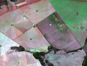
Photo: GEOEYE, Embrapa
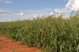
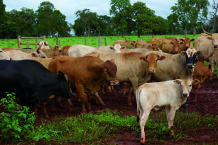
Data from 2006 the Agricultural Census indicate that the area of cultivated pasture in Brazil corresponds to about 106 million hectares. Since Brazilian cattle farming predominantly takes place in pastures, their degradation can represent economic and environmental damages for the sector. The process of pasture degradation is a complex phenomenon, which involves causes and consequences that lead to the gradual reduction of the pasture's support capacity. In order to adjust to the new environmental rules of the international and national markets, rehabilitate areas for agriculture, or increase profitability in the sector, the recovery of the degraded areas must be a priority in the livestock sector. Based on the demands for technological development for the sustainable use of degraded areas, this project aims to develop methods to identify and map the process of pasture degradation. Then it will be possible to make management tools that result in the exploration of degraded areas available for the development of production systems, for the sustainable exploration of agricultural production, and to reduce deforestation. Private and public companies and agencies' use of geotechnologies and geoinformation has grown considerably in their attempt to broadly and efficiently measure the magnitude of the problem and to inform public policy regarding decision-making on the recovery, management and use of such lands. Project goals include the development of geotechnologies to identify and monitor pasture degradation levels in the Amazon, Cerrado and Atlantic Rainforest biomes; the standardization, organization and integration of the different types of data obtained and generated by the project in a single information database; the identification of pasture degradation levels based on images by multispectral remote sensors; the identification of biophysical aspects concerning pasture degradation levels; and the obtainment of spatially explicit indicators of degradation of pasture areas based on integration and on geospatial crossings between the information plans generated and the different levels of degradation observed in the field. As results, the project will produce a technical-scientific book and a macrozoning, a summary document gathering thematic maps and explanatory texts showing the spatial dynamics of cattle farming in Brazil and pinpointing the main characteristics related to pasture degradation processes in the three biomes covered by the project. It is also expected to elaborate a Geographic Information System (GIS). For more information, access: http://www.geodegrade.cnpm.embrapa.br
Ecosystem: Amazonic, Atlantic Forest, Cerrados Region
Status: Completed Start date: Fri Apr 01 00:00:00 GMT-03:00 2011 Conclusion date: Wed Dec 31 00:00:00 GMT-03:00 2014
Head Unit: Embrapa Territorial
Project leader: Sandra Furlan Nogueira
Contact: sandra.nogueira@embrapa.br