GeoPecus - Geotechnologies applied to greenhouse gas dynamics in Brazilian agriculture
GeoPecus - Geotechnologies applied to greenhouse gas dynamics in Brazilian agriculture
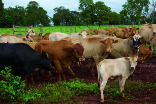
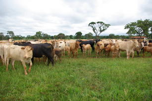
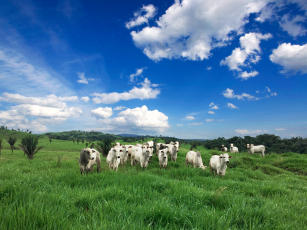
Photo: YAMAGISHI, Michel Eduardo Beleza
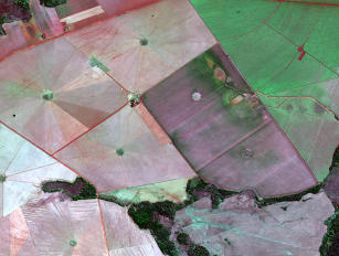
According to the Intergovernmental Panel on Climate Change (IPCC), a quarter of the national greenhouse gas (GHG) emissions comes from agricultural activities, and 93% of the CH4 emitted originates from enteric fermentation. Despite that, the agriculture practiced within given management standards can result in a lower GHG emissions. The GeoPecus project's goal is the application of geotechnologies for the understanding of the cause and effect relationship between agricultural activities and the GHG emission processes in the Amazon, Cerrado, Caatinga, Atlantic Rainforest, Pantanal, and Pampa biomes. Geotechnologies are important tools to spatialize and monitor natural resources, anthropic activities like cattle farming, and the consequences of such activities. The project is under the aegis of the Pecus research network, which deals with greenhouse gas dynamics in Brazilian agricultural production systems and aims at informing public policy and mitigation alternatives. GeoPecus project's specific goals have multi-scale approaches and are in line with the other projects that compose the research network. The update to pasture maps encompasses the domestic territory and provides an information framework for studies on process modeling and socioeconomic assessments. The spectro-temporal characterization covers experimental fields and comprises the development of methods for the identification of the status of pastures on a regional scale, and could inform studies to estimate potential carbon stocks in deficit situations (degraded pastures). The assessment of spatial variability is developed on a local scale to discuss and show the spatialization of carbon dynamics in production systems. As results, the project offers the update to the map of cultivated pastures in Brazil; the spectral and temporal characterization of the plant cover in the sample areas through remote sensing techniques, generating charts, maps and similar products; meteorological databases and time profiles of the vegetation index in sample areas; databases of the estimated values of plant biomass in the study areas; maps of spatial variability of carbon dynamics in production systems; a geographic information system (GIS) consolidating the information and the data obtained in the different Pecus research network's action plans; and a WebGIS that makes dynamic maps available on the Internet. For more information, access: http://www.cnpm.embrapa.br/projetos/geopecus/
Ecosystem: Amazonic, Atlantic Forest, Semi-mixed and seasonal forests, Pantanal, Caatinga Region and Mixed forests, Cerrados Region
Status: Completed Start date: Fri Apr 01 00:00:00 GMT-03:00 2011 Conclusion date: Sun Jul 31 00:00:00 GMT-03:00 2016
Head Unit: Embrapa Territorial
Project leader: Sandra Furlan Nogueira
Contact: sandra.nogueira@embrapa.br