GeoPortal - TerraClass
GeoPortal - TerraClass

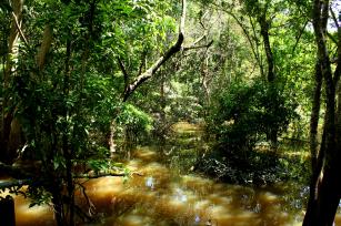
Photo: ROSA, Felipe Santos da
The GeoPortal - TerraClass is a geoinformation system designed to access and view land use and cover data identified in deforested areas of the Brazilian Amazon. It provides means to visualize, overlap and manipulate mappings in the TerraClass historical series, in a fast, free and intuitive way, through year comparison tools and mechanisms to obtain area and distance measurements on the map. The system also offers geographic services like generating graphs of sectors of the land use and land cover classes in different geographic sections at the regional, state, municipal and Water Planning Unit (UPH) levels. In addition, it is possible to generate transition matrices that show the dynamics between thematic classes of land use and cover, in different pairs of years, and transition diagrams that show the changes that occurred between all classes for all years, in an interactive and flexible manner, allowing the visualization of dynamic areas on the map. TerraClass is a project carried out through a partnership between Embrapa and the National Institute for Space Research (Inpe), which has generated systematic maps referring to land use and cover in all deforested areas of the Brazilian Amazon, identified by the Program for the Satellite Monitoring of Amazon Deforestation (Prodes). Through the Environmental Monitoring Program for Brazilian Biomes (PMABB) of the Ministry of the Environment, mapping and monitoring actions - including the identification of the deforestation rate, assessment of vegetation cover and land use, monitoring of fires, restoration of vegetation and selective extraction - , were expanded to the Cerrado and should include the other biomes, such as the Pantanal, the Atlantic Forest, the Caatinga and the Pampa. This technological solution was developed by Embrapa in partnership with Inpe's Regional Amazon Center (CRA / Belém, PA). It had the support of the Ministry of Science, Technology, Innovations and Communications (MCTIC); Ministry of Agriculture, Livestock and Food Supply (Mapa); Ministry of the Environment (MMA); World Bank; Foundation for Space Science, Applications and Technology (Funcate); and Amazon Fund.
This technological solution was developed by Embrapa in partnership with other institution(s).
Where to find:
http://www.terraclass.gov.br
Product: Software Launch year: 2018
Country: Brazil Region: Central-West, Northeast, Southeast State: Distrito Federal, Goiás, Mato Grosso, Mato Grosso do Sul, Bahia, Maranhão, Piauí, Acre, Amapá, Amazonas, Pará, Rondônia, Roraima, Tocantins, Minas Gerais, São Paulo, Paraná Biome: Amazon Rainforest, Cerrado
Responsible Unit: Embrapa Digital Agriculture
Participating Units: Embrapa Eastern Amazon
Keywords: TerraClass, WebGIS, uso e cobertura da terra, dinâmica

