Search Publications
Filter by:
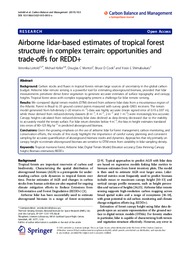 Author(s): LEITOLD, V.; KELLER, M.; MORTON, D. C.; COOK, B. D.; SHIMABUKURO, Y. E. Carbon stocks and fluxes in tropical forests remain large sources of uncertainty in the global carbon budget. Airborne lidar remote sensing is a powerful tool for estimating aboveground biomass, provi... ... |
 Author(s): LACERDA, M. P. C.; ALVES, H. M. R.; VIEIRA, T. G. C.; BILICH, M. R.; BARBOSA, I. O. The great urban and rural development of the Distrito Federal (Federal Administrative District) in Brazil over the last 50 years has led to disordered land use and land occupation. To assess the curre... ... |
 Author(s): GUIMARAES, D. P.; LANDAU, E. C.; COSTA, T. C. e C. da The Brazilian Geodetic Network is being modified to the geocentric system since the creation of SIRGAS (Geocentric Reference System for South America), a system identical to WGS 84 (Wor/d Geodetic Sys... ... |
 Author(s): SILVA, G. B. S. da; PEREIRA, K. C.; FARIA, D. P.; SOUZA, L. C. N. DE; NOGUEIRA, S. F. Pasture degradation process is a complex phenomenon: its causes and consequences lead to a gradual decrease in the pasture's carrying capacity and culminate with its degradation. Inadequate pasture ma... ... |
 Author(s): SABINO, H.; VASQUES, G. de M.; HERNANI, L. C.; DART, R. de O. O Sistema Plantio Direto (SPD) aplica técnicas agrícolas conservacionistas para preservação do solo, controlando processos de erosão. Para isso, é necessário conhecer as características do relevo que... ... |
 Author(s): AGUIAR, F. I. dos S.; PINHEIRO, H. S. K.; CARVALHO JUNIOR, W. de The research goal is to analyze terrain attributes obtained from a digital elevation model (DEM) to represent soil forming factors used in digital soil mapping at Bom Jardim county, Rio de Janeiro sta... ... |
 Author(s): SANTOS, P. A.; PINHEIRO, H. S. K.; CARVALHO JUNIOR, W. de; PEREIRA, N. R.; BHERING, S. B.; SILVA, I. L. The research goal is to analyze soil?s properties and associate them with the behavior and vertical variability of soil basic infiltration speed (bir) and saturated hydraulic conductivity (ksat) in so... ... |
 Author(s): WINKLER, A. S.; SILVA, J. T. da; PARFITT, J. M. B.; TEIXEIRA-GANDRA, C. F. A.; CONCENCO, G.; TIMM, L. C.
|
 Author(s): BASTOS, B.; PINHEIRO, H.; CARVALHO JUNIOR, W. de Aero geophysical data is becoming an important source of environmental covariate in digital mapping. Airborne gamma-ray spectrometry is more common in digital soil mapping, because of the penetration... ... |
 Author(s): HOLLER, W. A.; SERRATO, R. J.; GRAÇA, N. L. S. de S.; CRUZ, W. da; CRISTO, D. P. de Dentre as diversas tecnologias utilizadas para a geração de modelos tridimensionais da superfície terrestre, o uso de Aeronaves Remotamente Pilotadas, popularmente conhecida como Drone, surgem como al... ... |
Observation
Some of Embrapa's publications are published as ePub files. To read them, use or download one of the following free software options to your computer or mobile device. Android: Google Play Books; IOS: iBooks; Windows and Linux: Calibre.
Access other publications
Access the Agricultural Research Database (BDPA) to consult Embrapa's full library collection and records.
Visit Embrapa Bookstore to purchase books and other publications sold by Embrapa.