Search Publications
Filter by:
| |
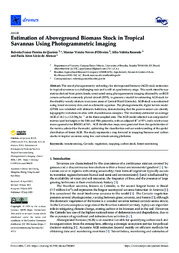
| Author(s): QUEIROZ, R. F. P.; OLIVEIRA, M. V. N. d'; REZENDE, A. V.; ALENCAR, P. A. L. de The use of photogrammetry technology for aboveground biomass (AGB) stock estimation in tropical savannas is a challenging task and is still at a preliminary stage. This work aimed to use metrics deriv... ... |
| Author(s): SILVA, A. de S.; FIGUEIREDO, E. O.; OLIVEIRA, M. V. N. d'; FIGUEIREDO, S. M. de M. O uso de Aeronaves Remotamente Pilotadas - RPAs (classe 3) para realização de inventários florestais, surge como uma alternativa relativamente barata e de grande flexibilidade de uso. O objetivo desse... ... |
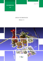
| Author(s): FIGUEIREDO, E. O.; FIGUEIREDO, S. M. de M. Este trabalho descreve planos de voo semiautônomos para fotogrametria com aeronaves remotamente pilotadas de classe 3. |
| Author(s): OLIVEIRA JÚNIOR, J. G. de; ESQUERDO, J. C. D. M.; LAMPARELLI, R. A. C. This article aimed to determine a workflow for more efficient large-scale crop mapping using a time series of images from the Sentinel-2 Satellite, statistical methods of attribute selection, and mach... ... |
| Author(s): LIMA, S. A.; COSTA, F. A. L.; BIAS, E. S.; SANO, E. E. The catastrophic floods that hit Rio Grande do Sul, Brazil, in May 2024 underscored the urgent necessity for sophisticated flood monitoring and management methods. Notably, Synthetic Aperture Radar (S... ... |
| Multitemporal segmentation of Sentinel-2 images in an agricultural intensification region in Brazil. Author(s): SANTOS, L. T. dos; WERNER, J. P. S.; REIS, A. A. dos; TORO, A. P. G.; ANTUNES, J. F. G.; COUTINHO, A. C.; LAMPARELLI, R. A. C.; MAGALHÃES, P. S. G.; ESQUERDO, J. C. D. M.; FIGUEIREDO, G. K. D. A. ABSTRACT: With the recent evolution in the sensor's spatial resolution, such as the MultiSpectral Imager (MSI) of the Sentinel-2 mission, the need to use segmentation techniques in satellite images ha... ... |
| Author(s): TORO, A. P. S. G. D.; WERNER, J. P. S.; REIS, A. A. dos; ESQUERDO, J. C. D. M.; ANTUNES, J. F. G.; COUTINHO, A. C.; LAMPARELLI, R. A. C.; MAGALHÃES, P. S. G.; FIGUEIREDO, G. K. D. A. ABSTRACT. Various approaches were developed considering the need to increase agricultural productivity in cultivated areas without more deforestation, such as the Integrated Crop livestock systems (IC... ... |
| Author(s): PARREIRAS, T. C.; BOLFE, E. L.; SANO, E. E.; VICTORIA, D. de C.; SANCHES, I. D.; VICENTE, L. E. ABSTRACT: Brazil has established itself as one of the world leaders in food production. Different types of remote sensing mapping techniques have been undertaken to support rural planning in the count... ... |
| Author(s): PRUDENTE, V. H. R.; SKAKUN, S.; OLDONI, L. V.; XAUD, H. A. M.; XAUD, M. R.; ADAMI, M.; SANCHES, I. D. A. Remote sensing has an important role in the Land Use and Land Cover (LULC) mapping process worldwide. Combining spaceborne optical and microwave data is essential for accurate classification in areas... ... |
Observation
Some of Embrapa's publications are published as ePub files. To read them, use or download one of the following free software options to your computer or mobile device. Android: Google Play Books; IOS: iBooks; Windows and Linux: Calibre.
Access other publications
Access the Agricultural Research Database (BDPA) to consult Embrapa's full library collection and records.
Visit Embrapa Bookstore to purchase books and other publications sold by Embrapa.

