Unidade
Embrapa Territorial
 Busca de Produtos e Serviços
GeoInfo | Embrapa Spatial Data Infrastructure (version 2.0)
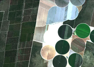
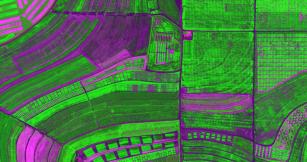
Photo: GEOEYE, Embrapa
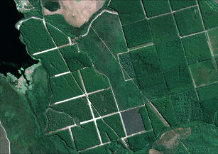
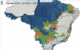
Geoinfo is a digital platform that stores, organizes and shares geospatial data generated by Embrapa1s research. As a a member of the National Spatial Data Infrastructure (INDE, from the acronym in Portuguese), Geoinfo makes data and metadata available in interoperable formats for society, which allows for information exchange in geoprocessing software. It is based on international rules and standards defined by the Open Geospatial Consortium (OGC) and per INDE's stipulation. It was built based on two free open source softwares: GeoNode and GeoNetwork. The new version 2.0 allows the creation of graphs and dashboards. In GeoInfo there are land use, cover and suitability maps; environmental zoning and diagnoses; soil surveys; pasture degradation estimates; carbon emissions; water production; and many other features.
Where to find:
https://geoinfo.dados.embrapa.br/#/
Methodology: Computerized procedure Launch year: 2024
Country: Brazil Region: North, Northeast, Central-West, Southeast State: Acre, Alagoas, Amapá, Amazonas, Bahia, Ceará, Distrito Federal, Espírito Santo, Goiás, Maranhão, Mato Grosso, Mato Grosso do Sul, Minas Gerais, Pará, Paraíba, Paraná, Pernambuco, Piauí, Rio de Janeiro, Rio Grande do Norte, Rio Grande do Sul, Rondônia, Roraima, Santa Catarina, São Paulo, Sergipe, Tocantins Biome: Amazon Rainforest, Cerrado, Atlantic Rainforest, Caatinga, Pampa, Pantanal
Responsible Unit: Embrapa Territorial
Keywords: dados de pesquisa, dados espaciais, gestão de dados, INDE

