Search Publications
Filter by:
| Author(s): ANDRADE, B. C. de; PEDREIRA, J. P. das N. C.; ROQUE, L. C. dos S.; VASQUES, G. M.; DART, R. de O.; BALIEIRO, F. de C.; SILVEIRA FILHO, T. B. Soil-landscape correlations are used to produce and interpret digital soil maps. Thisstudy aimsto present a methodology for obtaining and preparing environmental covariates related to soil formation (... ... |
| Land-use and land-cover mapping of the Brazilian cerrado based mainly on Landsat-8 satellite images. Author(s): SCARAMUZZA, C. A. de M.; SANO, E. E.; ADAMI, M.; BOLFE, E. L.; COUTINHO, A. C.; ESQUERDO, J. C. D. M.; MAURANO, L. E. P.; NARVAES, I. da S.; OLIVEIRA FILHO, F. J. B. de; ROSA, R.; SILVA, E. B. da; VALERIANO, D. de M.; VICTORIA, D. de C.; BAYMA, A. P.; OLIVEIRA, G. H. de; SILVA, G. B. S. da The Brazilian Cerrado is one of the world´s biodiversity hotspot and hosts some of the most intensive agricultural activities for food production in the world. The objective of this study was to produ... ... |
| Author(s): DOU, Y.; SILVA, R. F. B. da; BATISTELLA, M.; TORRES, S.; MORAN, E.; LIU, J. ABSTRACT. Agricultural trade and climate change have altered land cover and land use worldwide. For example, the recent growth of international soybean demand has been associated with 1.3 Mha primary... ... |
| Author(s): LU, D.; BATISTELLA, M.; MAUSEL, P.; MORAN, E. Mapping and monitoring land degradation in areas under human-induced stresses have urgent tasks in remote sensing whose importance has not yet been fully appreciated. In this study, a surface cover in... ... |
| Author(s): PRUDENTE, V. H. R.; SKAKUN, S.; OLDONI, L. V.; XAUD, H. A. M.; XAUD, M. R.; ADAMI, M.; SANCHES, I. D. A. Remote sensing has an important role in the Land Use and Land Cover (LULC) mapping process worldwide. Combining spaceborne optical and microwave data is essential for accurate classification in areas... ... |
| Author(s): CANTO, A. C. B. do; MARQUES, R.; LEITE, F. F. G. D.; SILVEIRA, J. G. da; DONAGEMMA, G. K.; RODRIGUES, R. de A. R. The land use change characterized by the conversion of native vegetation and forests to pastures and agricultural crops is one of the biggest drivers of deforestation in tropical regions. At the expen... ... |
| Author(s): ALMEIDA, C. A. de; COUTINHO, A. C.; ESQUERDO, J. C. D. M.; ADAMI, M.; VENTURIERI, A.; DINIZ, C. G.; DESSAY, N.; DURIEUX, L.; GOMES, A. R. Understanding spatial patterns of land use and land cover is essential for studies addressing biodiversity, climate change and environmental modeling as well as for the design and monitoring of land u... ... |
| Author(s): VIEL, J. A.; ROSA, K. K. da; HOFF, R.; MOURA, N. S. V. The objective of this study was to investigate the land use and land cover patterns in the region Vale dos Vinhedos designation of origin and to relate them to the geomorphological mapping aiming to c... ... |
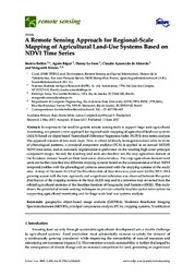
| Author(s): BELLÓN, B.; BEGUÉ, A.; LO SEEN, D.; ALMEIDA, C. A. de; SIMÕES, M. In response to the need for generic remote sensing tools to support large-scale agricultural monitoring, we present a new approach for regional-scale mapping of agricultural land-use systems (ALUS) ba... ... |
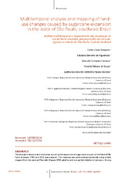
| Author(s): RONQUIM, C. C.; FIGUEIREDO, E. B. DE; FONSECA, M. F.; SOUZA, D. T. de; SILVA, G. A. V. F. DA Mapeou-se a mudança de uso e cobertura da terra impulsionada pela expansão da cana-de-açúcar em parte do estado de São Paulo, entre 1988 e 2016. O mapeamento foi feito de forma automática usando image... ... |
Observation
Some of Embrapa's publications are published as ePub files. To read them, use or download one of the following free software options to your computer or mobile device. Android: Google Play Books; IOS: iBooks; Windows and Linux: Calibre.
Access other publications
Access the Agricultural Research Database (BDPA) to consult Embrapa's full library collection and records.
Visit Embrapa Bookstore to purchase books and other publications sold by Embrapa.

