Search Publications
Filter by:
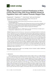
| Author(s): ZHU, C.; LU, D.; VICTORIA, D. de C.; DUTRA, L. V. Mapping cropland distribution over large areas has attracted great attention in recent years, however, traditional pixel-based classification approaches produce high uncertainty in cropland area stati... ... |
| Author(s): LU, D.; LI, G.; BATISTELLA, M.; FREITAS, C. C. This research explored the integrated use of Landsat Thematic Mapper (TM) and radar (i.e., ALOS PALSAR L-band and RADARSAT-2 C-band) data for mapping impervious surface distribution to examine the rol... ... |
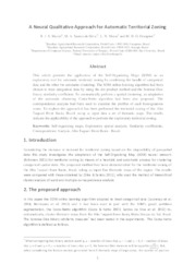
| Author(s): MACIEL, R. J. S.; SILVA, M. A. S. da; MATOS, L. N.; DOMPIERI, M. H. G. This article presents the application of the Self-Organizing Maps (SOM) as an exploratory tool for automatic territorial zoning by combining the handle of categorical data and the other for automatic... ... |
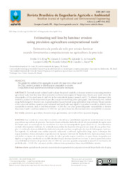
| Author(s): KRUG, E. T. S.; GOMES, G. J.; SOUZA, E. G. de; GEBLER, L.; SOBJAK, R.; BAZZI, C. L. ABSTRACT: The study aimed to identify and evaluate the spatial variability in laminar erosion in areas using precision agriculture tools. Soil data from three properties in the western region of Paran... ... |
| Author(s): ZANETTI, M. R.; PUGLIERO, V. S.; ALMEIDA, M. B. de; ASSAD, E. D. Resumo - A análise da acurácia entre mapeamentos de fontes diversas é a metodologia mais difundida para estimar taxas de acerto e erro em produtos cartográficos. Essa metodologia consiste na comparaçã... ... |
| Author(s): MENGATTO JUNIOR, E. A.; SILVA, J. dos S. V. da; OLIVEIRA, R. C. de Este trabalho objetiva apresentar funcionalidades de análise espacial no SIAGEO a partir da disponibilidade de dados do Pantanal e da Amazônia. |
| Author(s): CASSIANO, C. S.; ADAMI, S. F.; OLIVEIRA, S. R. de M.; COELHO, R. M. Resumo - A validação em campo de um mapa pedológico é necessária para que este possua aplicabilidade. Esta pesquisa buscou aplicar a validação de unidades de mapas de solos tradicional e digital da fo... ... |
| |
| Author(s): SILVA, J. dos S. V. da; ABDON, M. de M.; SILVA, S. M. A. da; MORAES, J. A. de Maps elaborated from five different periods were recovered and inserted within a single GIS. Considering these maps, the evolution of deforestation in the Pantanal and its surroundings in Brazil was a... ... |
| Author(s): SPERANZA, E. A.; TORRE-NETO, A.; RODRIGUES, E. L.; GREGO, C. R. Este trabalho teve como objetivo desenvolver um aplicativo computacional capaz de gerar mapas georreferenciados úteis para a tomada de decisão em irrigação de precisão. Para tanto, foram utilizadas as... ... |
Observation
Some of Embrapa's publications are published as ePub files. To read them, use or download one of the following free software options to your computer or mobile device. Android: Google Play Books; IOS: iBooks; Windows and Linux: Calibre.
Access other publications
Access the Agricultural Research Database (BDPA) to consult Embrapa's full library collection and records.
Visit Embrapa Bookstore to purchase books and other publications sold by Embrapa.

