Busca de Publicações
Filtrar por:
| Autoria: EVA, H. D.; BELWARD, A. D.; MIRANDA, E. E. de; DI BELLA, C. M.; GONDS, V.; HUBER, O.; JONES, S.; SGRENZAROLI, M.; FRITZ, S. A digital land cover map of South America has been produced using remotely sensed satellite data acquired between 1995 and the year 2000. The mapping scale is defined by the 1 km spatial resolution of... ... |
| Autoria: IGANCI, J. R. V.; KULLKAMP, J.; PLA, C.; DORNELLES, M.; SARKINEN, T.; HEIDEN, G.
|
| |
| Autoria: LU, D.; BATISTELLA, M.; MORAN, E.; MAUSEL, P. Abundant vegetation species and associated complex forest stand structures in moist tropical regions often create difficulties in accurately classifying land-use and land-cover (LULC) features. This p... ... |
| Autoria: LUZ, C. C. da S.; RAMOS, A. W. P.; BARROS, C. A. de; NEVES, S. M. A. da S.; SILVA, J. dos S. V. da; GALVANIN, E. A. dos S. Resumo. O objetivo deste estudo é aplicar os índices de vegetação Normalized Difference Vegetation Index (NDVI) e Enhanced Vegetation Index (EVI) para análise da dinâmica temporal da cobertura vegetal... ... |
| Autoria: MELLO, M. P. de; PRADO, B. R. do; SILVA, G. B. S. da; SHIMABUKURO, Y. E.; SANO, E. E. ABSTRACT - The Cerrado biome covers more than two million km² in the central region of Brazil. It is the second largest biome in this country, presenting rich biodiversity. Remote sensing is a useful... ... |
| Autoria: ANDRADE, R. G.; HOTT, M. C.; MAGALHAES JUNIOR, W. C. P. de; PACIULLO, D. S. C.; GOMIDE, C. A. de M. Traditional procedures for biomass estimation usually use destructive methods with great demands on time, resources, and labor. The development of models for automated estimation of pasture biomass, p... ... |
| Autoria: MAYAUX, P.; EVA, H.; GALLEGO, J.; STRAHLER, A. H.; HEROLD, M.; AGRAWAL, S.; NAUMOV, S.; MIRANDA, E. E. de; DI BELLA, C. M.; ORDOYNE, C.; KOPIN, Y.; ROY, P. S. The Joint Research Centre of the European Commission (JRC), in partnership with 30 institutions, has produced a global land cover map for the year 2000, the GLC 2000 map. The validation of the GLC2000... ... |
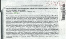
| Native vegetation suppression in the upland areas of three sub-basins of upper Paraguay river basin. Autoria: PADOVANI, C. R.; DIAS, F. A.; SOUZA, G. F.; CALHEIROS, D. F.
|
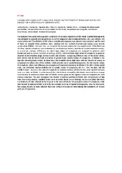
| Autoria: VEDOVATO, L. B.; VICENTE, L. E.; PIQUEIRA, J. R. C.; LOEBMANN, D. G. dos S. W.; MATTOS, S. H. V. L. We analysed the spatial heterogeneity complexity of Cerrado vegetation of São Paulo. Spatial heterogeneity was obtained by quantity texture patterns on ASTER images for Jataí Ecological Station (JES;... ... |
Observações
1 - Por padrão são exibidas publicações dos últimos 20 anos. Para encontrar publicações mais antigas, configure o filtro ano de publicação, colocando o ano a partir do qual você deseja encontrar publicações. O filtro está na coluna da esquerda na busca acima.
2 - Para ler algumas publicações da Embrapa (apenas as que estão em formato ePub), é necessário ter, no celular ou computador, um desses softwares gratuitos. Sistemas Android: Google Play Livros; IOS: iBooks; Windows e Linux: software Calibre.
Acesse outras publicações
Acesse a Base de Dados da Pesquisa Agropecuária (BDPA) para consultar o acervo completo das bibliotecas da Embrapa.

