Busca de Publicações
Filtrar por:
| Autoria: ZHU, C.; LU, D.; VICTORIA, D. de C.; DUTRA, L. V. Mapping cropland distribution over large areas has attracted great attention in recent years, however, traditional pixel-based classification approaches produce high uncertainty in cropland area stati... ... |
| Autoria: VENDRAMINI, W. J.; NEVES, S. M. A. da S.; KREITLOW, J. P.; GALVANIN, E. A. dos S.; SILVA, J. dos S. V. da Analyzing the urban space related to its own growth allows to identify the identification of the dynamics of the natural elements and the way the intensified anthropic action shapes and at the same ti... ... |
| Autoria: ALENCAR, A.; SHIMBO, J. Z.; LENTI, F.; MARQUES, C. B.; ZIMBRES, B.; ROSA, M.; ARRUDA, V.; CASTRO, I.; RIBEIRO, J. P. F. M.; VARELA, V.; ALENCAR, I.; PIONTEKOWSKI, V.; RIBEIRO, V.; BUSTAMANTE, M. M. C.; SANO, E. E.; BARROSO, M. Widespread in the subtropics and tropics of the Southern Hemisphere, savannas are highly heterogeneous and seasonal natural vegetation types, which makes change detection (natural vs. anthropogenic) a... ... |
| Autoria: KIYOHARA, B. H.; SANO, E. E. Abstract: The re-suppression of secondary vegetation (SV) in the Brazilian Amazon for agriculture or land speculation occurs mostly in the rainy season. The use of optical images to monitor such re-su... ... |
| Autoria: MAYAUX, P.; EVA, H.; GALLEGO, J.; STRAHLER, A. H.; HEROLD, M.; AGRAWAL, S.; NAUMOV, S.; MIRANDA, E. E. de; DI BELLA, C. M.; ORDOYNE, C.; KOPIN, Y.; ROY, P. S. The Joint Research Centre of the European Commission (JRC), in partnership with 30 institutions, has produced a global land cover map for the year 2000, the GLC 2000 map. The validation of the GLC2000... ... |
| Autoria: EVA, H. D.; BELWARD, A. D.; MIRANDA, E. E. de; DI BELLA, C. M.; GONDS, V.; HUBER, O.; JONES, S.; SGRENZAROLI, M.; FRITZ, S. A digital land cover map of South America has been produced using remotely sensed satellite data acquired between 1995 and the year 2000. The mapping scale is defined by the 1 km spatial resolution of... ... |
| Autoria: PASSOS, F. B.; VILELA, M. de F.; AQUINO, F. de G.
|
| Autoria: CARVALHO JÚNIOR, O. A. de; COELHO, M. A. N.; MARTINS, E. de S.; GOMES, R. A. T.; COUTO JÚNIOR, A. F.; OLIVEIRA, S. N. de; SANTANA, O. A. O manejo e o monitoramento ecológico de parques nacionais e outras áreas protegidas requerem uma detalhada descrição do padrão de distribuição da vegetação. Esse artigo possui como objetivo produzir u... ... |
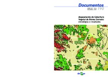
| Autoria: SANO, E. E.; ROSA, R.; BRITO, J. L. S.; FERREIRA, L. G. ABSTRACT: Mapping Cerrado's vegetation cover is difficult because of its geographical extemt (~ 204,7 million hectares), high seasonality, and high spatial and temporal dynamics of its land use activi... ... |
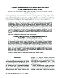
| Autoria: VICTORIA, D. de C.; PAZ, A. R. DA; COUTINHO, A. C.; KASTENS, J.; BROWN, J. C. The objective of this work was to evaluate a simple, semi‑automated methodology for mapping cropland areas in the state of Mato Grosso, Brazil. A Fourier transform was applied over a time series... ... |
Observações
1 - Por padrão são exibidas publicações dos últimos 20 anos. Para encontrar publicações mais antigas, configure o filtro ano de publicação, colocando o ano a partir do qual você deseja encontrar publicações. O filtro está na coluna da esquerda na busca acima.
2 - Para ler algumas publicações da Embrapa (apenas as que estão em formato ePub), é necessário ter, no celular ou computador, um desses softwares gratuitos. Sistemas Android: Google Play Livros; IOS: iBooks; Windows e Linux: software Calibre.
Acesse outras publicações
Acesse a Base de Dados da Pesquisa Agropecuária (BDPA) para consultar o acervo completo das bibliotecas da Embrapa.

